
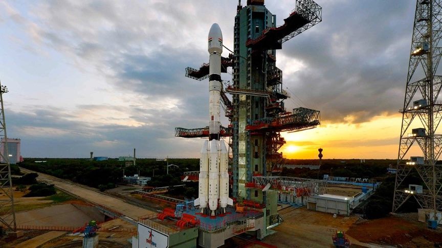
Standing on a plume of rocket exhaust, an ISRO Geosynchronous Satellite Launch Vehicle (GSLV) carried a large earth monitoring satellite into orbit after lifting off shortly after 8:00 p.m. Eastern time.
The rocket carried the NISAR (NASA-ISRO Synthetic Aperture Radio) satellite and inserted it into an orbit that will allow it to capture detailed, three dimensional views of Earth. The satellite is the result of a years-long joint effort by both NASA and ISRO and stems from a program that NASA says was supported by both President Trump and Indian Prime Minister Narendra Modi. The satellite's mission will be to monitor disaster responses, infrastructure on Earth, and agricultural monitoring.
“Congratulations to the entire NISAR mission team on a successful launch that spanned across multiple time zones and continents in the first-ever partnership between NASA and ISRO on a mission of this sheer magnitude,” said Nicky Fox, associate administrator, Science Mission Directorate at NASA Headquarters in Washington. “Where moments are most critical, NISAR’s data will help ensure the health and safety of those impacted on Earth, as well as the infrastructure that supports them, for the benefit of all.”
NISAR features two advanced radar systems, an L-band radar provided by NASA's Jet Propulsion Laboratory in California and an S-band radar developed by ISRO's Space Applications Centre in Ahmedabad.
“We’re proud of the international team behind this remarkable satellite. The mission’s measurements will be global but its applications deeply local, as people everywhere will use its data to plan for a resilient future,” said Dave Gallagher, director, NASA JPL, which manages the U.S. portion of the mission for NASA. “At its core is synthetic aperture radar, a technology pioneered at NASA JPL that enables us to study Earth night and day, through all kinds of weather.”
Key Facts About the NISAR Satellite
According to the Jet Propulsion Laboratory, there are several key facts and features about the NISAR satellite.
The satellite will provide a 3D view of Earth's land mass and ice cover. "NISAR will detect changes in the planet’s surface down to fractions of an inch," JPL notes. "The satellite’s ability to “see” through clouds and light rain, day and night, will enable data users to continuously monitor earthquake- and landslide-prone areas and determine how quickly glaciers and ice sheets are changing."
NISAR data will be used for disaster preparation. The satellite will be able to closely monitor faults for signs of earthquakes and volcanoes for signs of eruption activity. It will also be able to monitor threats to structures like dams and levees.
The satellite is "about the length of a pickup truck," JPL notes, and its "radars will generate about 80 terabytes of data products per day over the course of NISAR’s prime mission. That’s roughly enough data to fill about 150 512-gigabyte hard drives each day. The information will be processed, stored, and distributed via the cloud — and accessible to all," says JPL.
NISAR data will be used to monitor both land and ice twice every 12 days. "The NISAR satellite’s L-band radar penetrates deep into forest canopies, providing insights into forest structure, while the S-band radar is ideal for monitoring crops. The NISAR data will help researchers assess how forests, wetlands, agricultural areas, and permafrost change over time," said JPL.


